


Price: $24.99
(as of Oct 03, 2024 17:13:29 UTC – Details)

Product Description


Tiger Moon Pictorial Maps
Our carefully-crafted collection of illustrated maps boasts accurate data detailing cities, towns and land features. Plus, each of our maps include vivid images of a wide range of notable points of interest. You’ll be equipped to explore, learn the geography of the region, plan a journey, or even teach others! You’ll be ready to trek the terrain and discover the wonders of the land – from ancient cities to plentiful treasures. Plus, our map’s eye-catching visuals mean it looks as good on your wall as the sights you’ll see on your journey. Get your chance to explore the world without ever leaving your home!
Our Maps are; DURABLE; Printed onto high quality poster paper and laminated for durability. INFORMATIVE; Highly detailed with easy to read fonts. EDUCATIONAL; Our maps are versatile, able to be used in a classroom or for home learning.


Add to Cart
Add to Cart
Add to Cart
Add to Cart
Add to Cart
Customer Reviews
5.0 out of 5 stars
2
5.0 out of 5 stars
5
4.6 out of 5 stars
8
4.2 out of 5 stars
35
4.3 out of 5 stars
21
Price
$14.99$14.99 $24.99$24.99 $24.99$24.99 $24.99$24.99 $20.99$20.99
Size
23.3 x 26.1 Inches 23.4 x 16.5 Inches 23.4 x 16.5 Inches 23.4 x 16.5 Inches 23.4 x 16.5 Inches
Variation
Paper Laminated Paper Laminated Paper Laminated Paper Laminated Paper Laminated
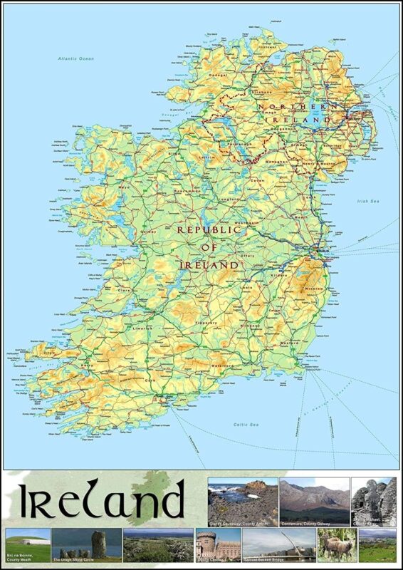
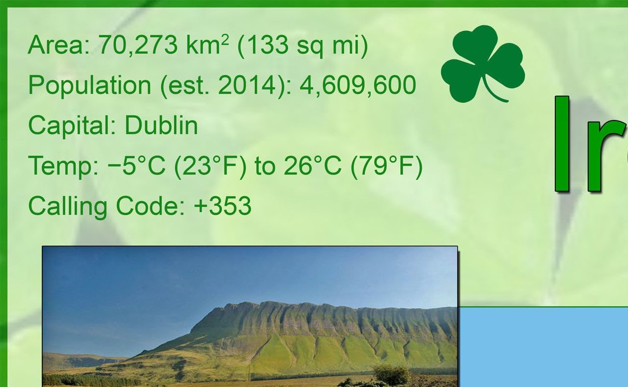
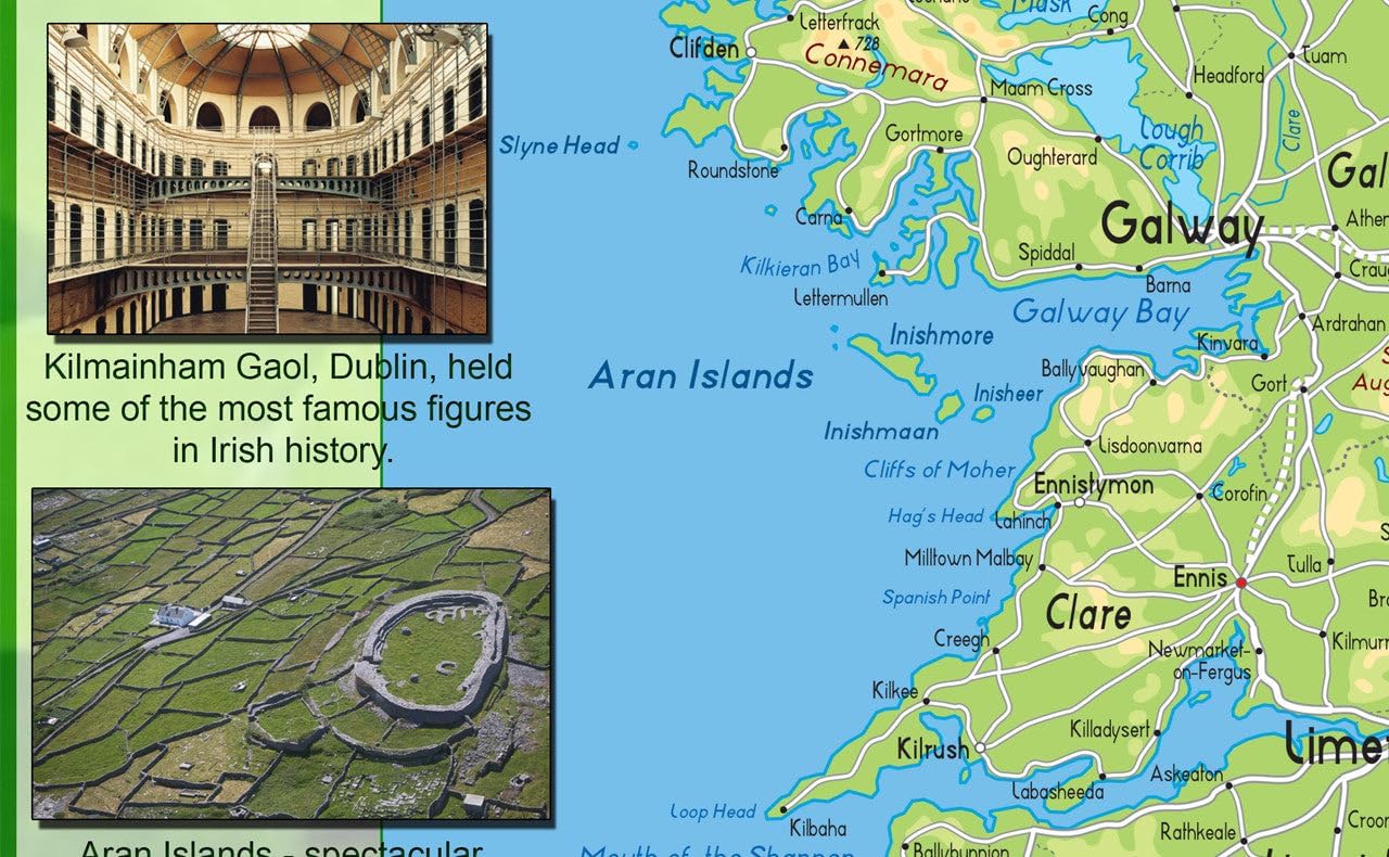
This gorgeous illustrated map of Ireland showcases the physical features of the Emerald Isle, from bustling cities to majestic bodies of water. Unearth sites like Aran Islands, Blarney Castle, The City of Galway and The Cliffs of Moher in bright, vivid color – ideal for anyone wanting to discover Ireland, comprehend its geography, or discover their lineage.
Size – 23.4 x 16.5 inches.
Paper Laminated – Printed on high quality paper which is then finished with a durable gloss laminate..